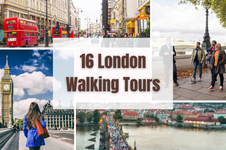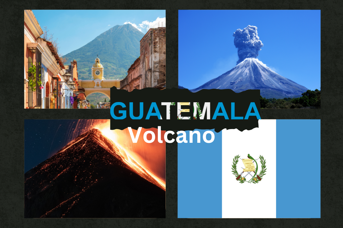
Guatemala Volcano: Top 23 Hikes You must checkout
Guatemala volcano is a region known for its high volcanic activity. With over 30 volcanoes, it plays a vital role in the country’s natural and cultural heritage.
Some volcanoes are still active, and some are extinct, making Guatemala part of the Pacific Ring of Fire. With its dramatic volcanic landscapes and uneven terrain, Guatemala Volcano has become a land of stunning natural beauty.
Importance of Volcanoes to the Country’s Geography, Culture, and Tourism
Guatemala volcanoes are shaped by geographical features that influence a country’s local climate, hydrology, culture, and tourism. It also helps in enhancing soil fertility, which supports the country’s agriculture.
Culturally, volcanoes are significant for the native communities, as they are integral to their mythologies, customs, and religious rituals.
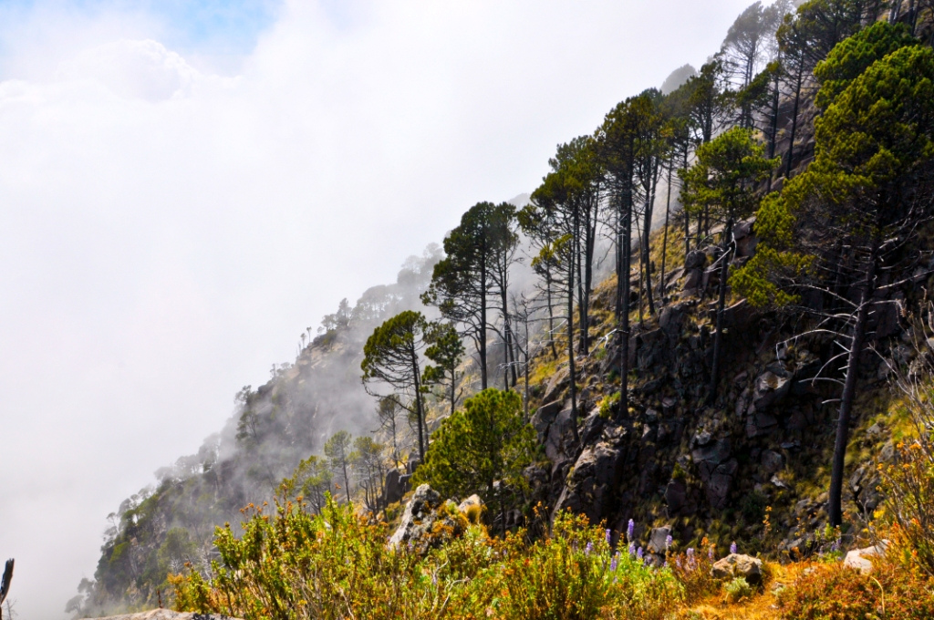
In recent years, volcano tourism has boomed. Guatemala is a country that is known for its stunning volcanic landscapes, offering numerous hiking opportunities.
Travellers with an adventurous spirit come to the nation to explore these magnificent peaks, see volcanic eruptions, and take in the expansive vistas. Hikes that are well-known, such as Pacaya, Acatenango, and Santa María, provide distinctive experiences that attract travellers who love the outdoors.
23 Best Guatemala Volcano Hikes
Check out the amazing Guatemala Volcanoes that offer hiking opportunities with breathtaking views. Don’t forget to read our safety measures before hiking.
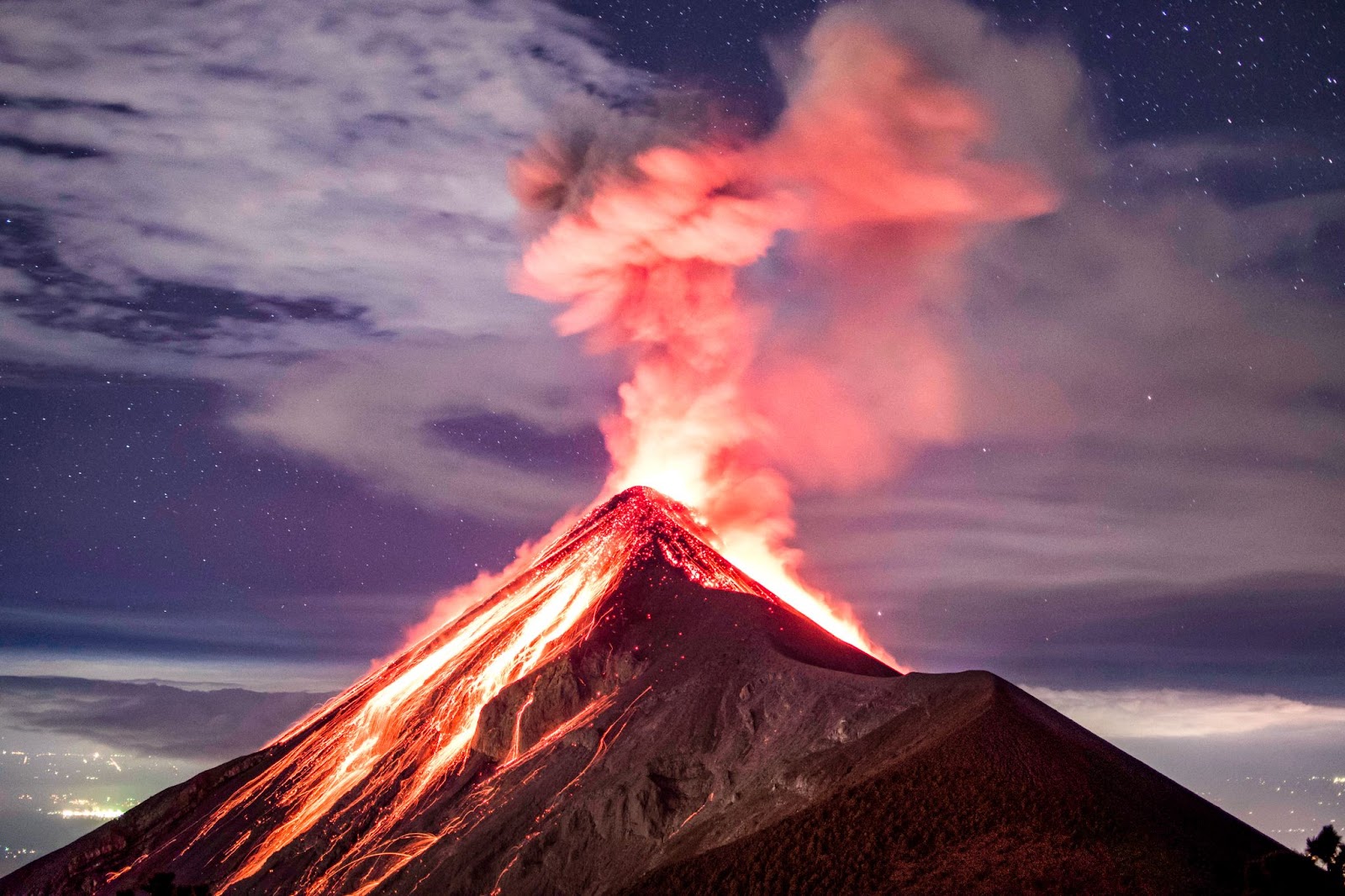
1. Volcán de Fuego
Elevation: 3,763 m
Location: Located in south-central Guatemala, near the city of Antigua and about 16 kilometers from the colonial city itself. It is part of the volcanic complex that includes Acatenango.
Duration: It’s not advisable to go hiking directly on Volcán de Fuego because of its regular eruptions. However, it usually takes 1-2 days to do the neighboring Acatenango walk, which offers views of Fuego and requires an overnight stay to witness the eruptions at night.
Hiking difficulty: The hike up Acatenango is considered strenuous due to its steep and sustained elevation gain.
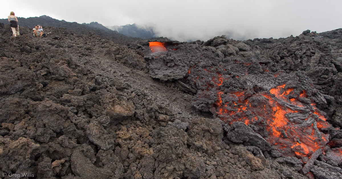
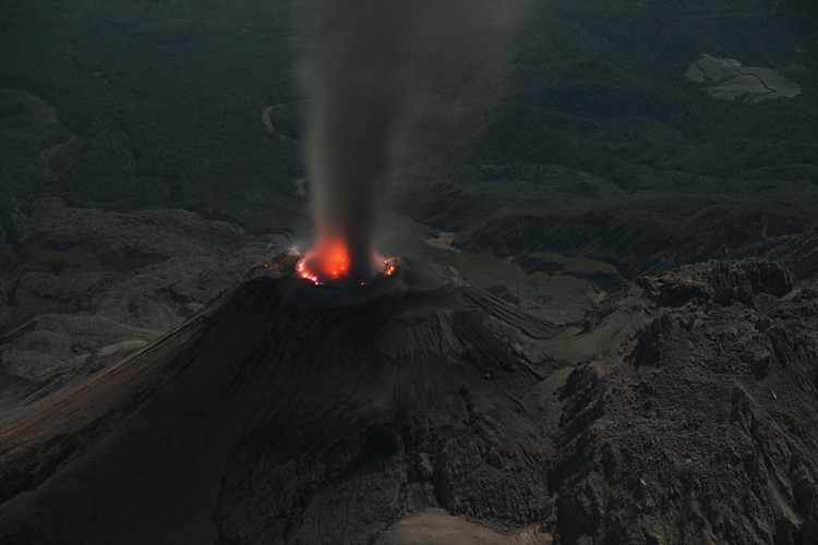
Unique feature: Among other Guatemala volcanoes, Fuego is renowned for its persistent activity, with frequent explosive eruptions that can produce dramatic displays of ash plumes and lava flows. It is one of the most active volcanoes in Central America and offers you an opportunity to observe volcanic activity safely from the summit of Acatenango.
2. Pacaya
Elevation: 2,552 m
Location: Escuintla Department of Guatemala, approximately 25 kilometers southwest of Guatemala City. It is part of Pacaya National Park.
Duration: 2-3 hours round trip
Hiking difficulty: Easy. The trail has a steady incline but is generally well-maintained and suitable for you if you are a beginner.
Unique feature: It is known for its active glowing lava flows. It allows you to capture the panoramic views of surrounding volcanoes and the Pacific coastal plain.
3. Acatenango
Elevation: 3,976 m
Location: Located near the city of Antigua. It is part of the volcanic complex that includes the active Volcán de Fuego.
Duration: The hike typically takes 1-2 days. Most hikers opt for an overnight stay near the summit to witness the sunrise and the nighttime eruptions of Volcán de Fuego.
Hiking difficulty: The hike is considered to be challenging due to its steep and sustained elevation gain.
Unique feature: Among 23 Guatemala Volcanoes, Acatenango is one of the most famous volcanoes. You can witness breathtaking eruptions from Fuego from the peak or the campsite on Acatenango, offering an adventurous experience and magnificent views of neighboring mountains.
4. Santa María
Elevation: 3,772 m
Location: Located in the western highlands of Guatemala, near the city of Quetzaltenango (Xela), in the Quetzaltenango department.
Duration: The hike typically takes about 8–10 hours round-trip. Most hikers start early in the morning to reach the summit and return by late afternoon.
Hiking difficulty: Difficult but rewarding
Unique feature: This volcano is notable for its dramatic 1902 eruption. From the summit of Santa Maria, you can see the stunning views of the active Santiaguito lava dome, which has been continuously erupting since 1922.
5. Volcán Tajumulco
Elevation: 4,220 m
Location: San Marcos Department of Western Guatemala, near the border with Mexico.
Duration: 1-2 days
Hiking difficulty: Moderately difficult due to the high elevation.
Unique feature: Volcán Tajumulco has the highest elevation among other Guatemala volcanoes. It offers panoramic views extending as far as the Pacific Ocean and into Mexico on a clear day. You will see the diverse landscapes, including forests and alpine meadows. It also provides an excellent opportunity to experience high-altitude trekking.
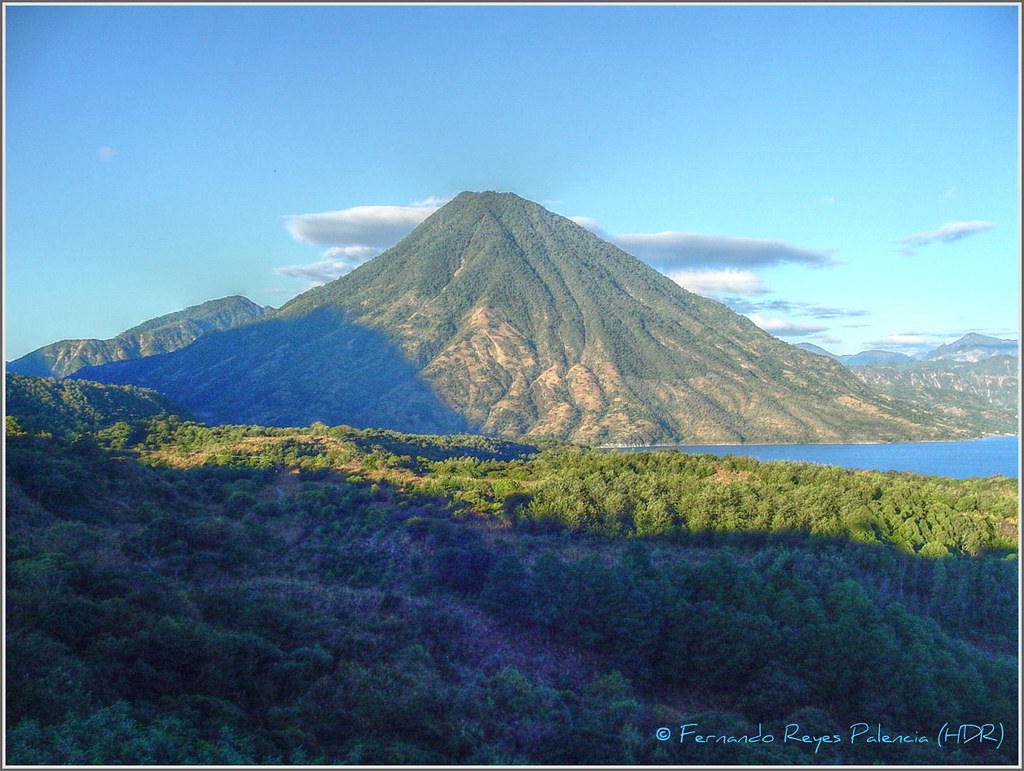
6. Volcán Tolimán
(Volcán Tolimán with Volcán Atitlán)
Elevation: 3,158 m
Location: Sololá department of Guatemala, near the southern shore of Lake Atitlán. It is situated between the towns of Santiago Atitlán and San Lucas Tolimán.
Duration: 6–8 hours round trip.
Hiking difficulty: Moderately difficult.
Unique feature: You can capture a serene environment and breathtaking views of Lake Atitlán and its surrounding volcanoes, including Volcán Atitlán and Volcán San Pedro. During hiking, you will pass through diverse ecosystems, including coffee plantations, corn fields, and cloud forests.
7. Almolonga (Cerro Quemado)
Elevation: 3,197 m
Location: Near the city of Quetzaltenango (also known as Xela).
Duration: 4 to 6 hours round trip
Hiking difficulty: Moderate to challenging.
Unique feature: You will capture panoramic views of the Quetzaltenango Valley, nearby mountains, volcanic features, and a complex of lava domes.
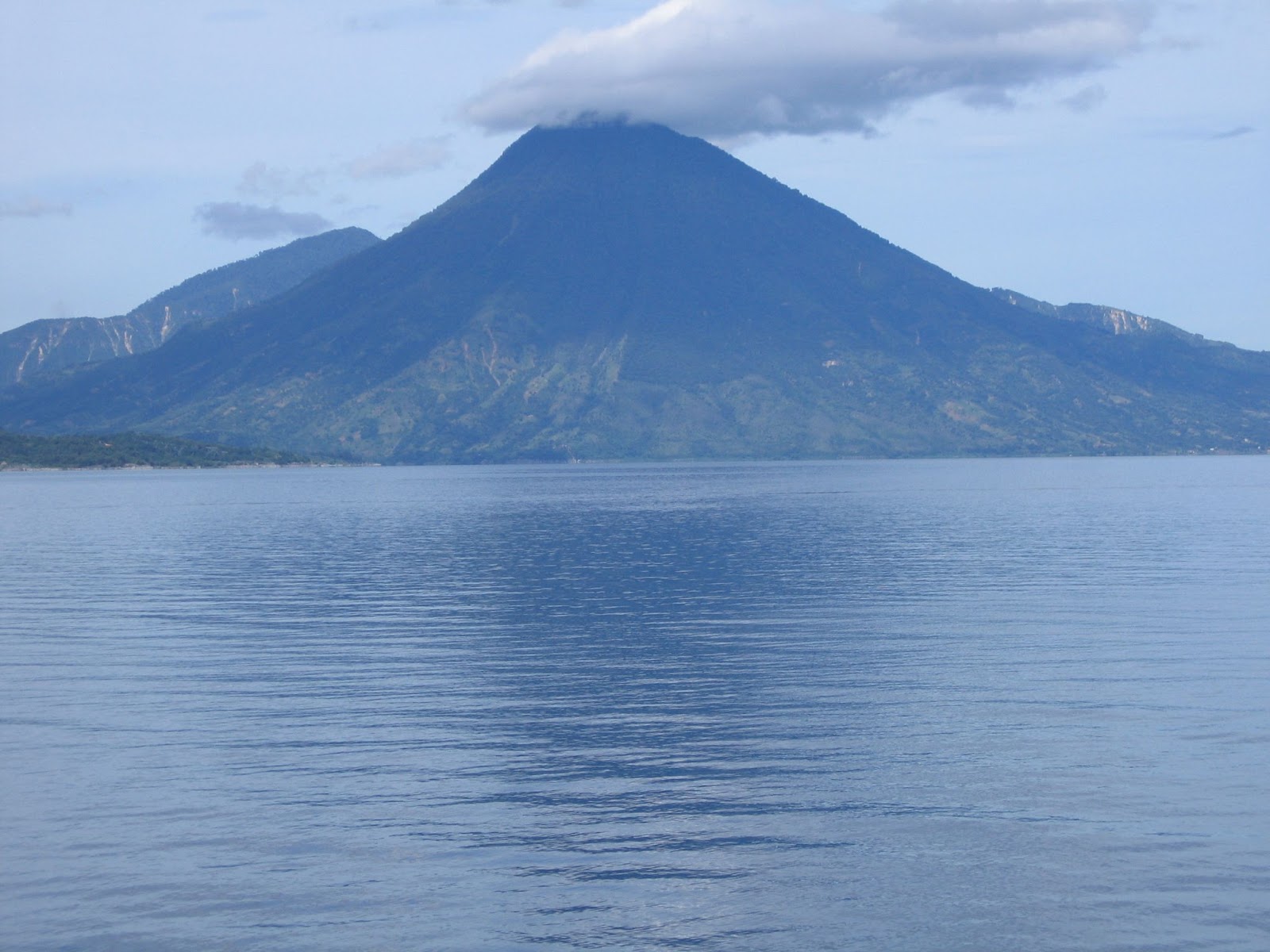
8. Volcán Atitlán
Elevation: 3,535 m
Location: Located in the Sololá department of Guatemala, near the southern shore of Lake Atitlán, and it is part of a volcanic complex that includes Volcán Tolimán and Volcán San Pedro. The nearest town is Santiago Atitlán.
Duration: 8–12 hours round trip.
Hiking difficulty: Difficult as compared to other Guatemala volcanoes.
Unique feature: This volcano in Guatemala offers an incredible view of Lake Atitlán, the highlands, and its surrounding volcanoes, such as Tolimán and San Pedro. The volcano’s slopes are covered in lush cloud forests and diverse ecosystems, making the hike scenically rewarding.
9. Volcán San Pedro
Elevation: 3,020 m
Location: Located on the southwestern shore of Lake Atitlán in the Sololá department of Guatemala, near the town of San Pedro La Laguna.
Duration: 4 to 6 hours round trip.
Hiking difficulty: Moderate to difficult.
Unique feature: It is known for its stunning panoramic views of Lake Atitlán, its surrounding volcanoes (Tolimán and Atitlán), and the picturesque villages along the lake’s shores. It provides you with a rich hiking experience as you will pass through coffee plantations, cloud forests, and diverse ecosystems.
10. Agua Volcano
Elevation: 3,760m
Location: Located in the Sacatepéquez department of Guatemala, near Antigua and Escuintla.
Duration: 5 to 7 hours round trip.
Hiking difficulty: Moderate
Unique feature: One of the Guatemala volcanoes that is renowned for having a symmetrical cone shape and providing magnificent views of the Pacific coastal plain, Lake Amatitlán, and neighboring volcanoes (including Fuego and Acatenango). Due to a devastating mudslide that occurred in 1541, the volcano played a crucial role in the evacuation of the old Guatemalan capital.
11. Volcán Ipala
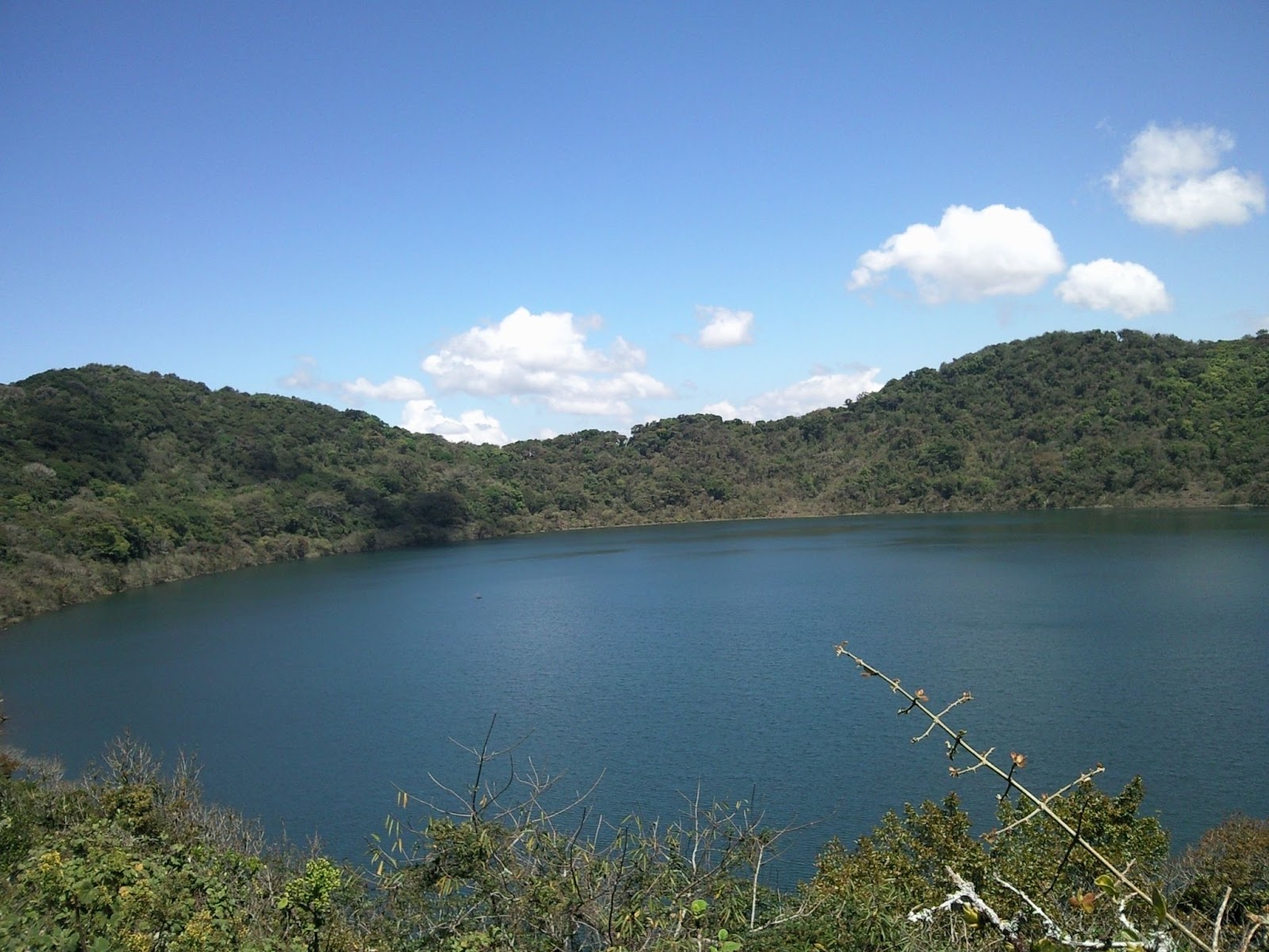
Elevation: 1,650 m
Location: Located in the Chiquimula department of southeastern Guatemala, near the border with El Salvador. It is situated between the towns of Ipala and Chiquimula.
Duration: 1-2 hours to reach the summit.
Hiking difficulty: Easy to moderate. Beginner friendly.
Unique feature: The summit crater lake, Laguna de Ipala, is the most distinctive feature of Volcán Ipala. Sprawled with beautiful flora, the lake provides an idyllic setting perfect for your leisure and discovery. It’s a well-liked volcano as compared to other Guatemala Volcanoes because of the peaceful lake and the volcanic scenery.
12. Chingo
Elevation: 1,775 m
Location: Located on the border between Guatemala and El Salvador, specifically in the departments of Jutiapa in Guatemala and Santa Ana in El Salvador.
Duration: 3–4 hours round trip.
Hiking difficulty: Moderate.
Unique feature: Its position on the international border allows you to experience both Guatemalan and Salvadoran landscapes.
13. Volcán de Flores
Elevation: 1,600 m
Location: Located in the Santa Rosa department of Guatemala, near the town of Flores Costa Cuca. It is situated in the southwestern part of the country, not far from the Pacific coast.
Duration: 3 to 4 hours round trip.
Hiking difficulty: Easy to moderate.
Unique feature: In comparison to other Guatemala volcanoes, it is comparatively low in elevation, making it a more likable volcano with breathtaking views. The diversity of the volcano’s flora and fauna enhances the climbing experience. You will be mesmerized by the views of the Pacific Ocean and the surrounding farmland.
14. Volcán Santo Tomás
Elevation: 3,542 m
Location: Located in the Quetzaltenango department of Guatemala, near the town of Zunil. It is part of the Sierra Madre mountain range.
Duration: 6–8 hours round trip.
Hiking difficulty: Difficult due to the significant elevation gain and steep sections of the trail.
Unique feature: It is renowned for its breathtaking panoramic views from the top, which on clear days even include views of the Pacific Ocean and the neighboring city of Quetzaltenango. During the hike, you will pass through a variety of environments, such as high-altitude meadows and cloud forests. The volcano is also home to the Fuentes Georginas thermal hot springs, which provide a soothing experience after a walk.
15. Cerro de Coxóm
Elevation: 3,045 m
Location: Located in the Sololá department of Guatemala, near the town of San Juan La Laguna and Lake Atitlán. It is part of the Sierra Madre mountain range.
Duration: 4 to 6 hours round trip.
Hiking difficulty: Moderate to difficulty.
Unique feature: It offers breathtaking views of the neighboring volcanoes, including Tolimán, Atitlán, and San Pedro, as well as Lake Atitlan. From the top, you will also capture a broad view of the lake and the highlands.
The hike of Cerro de Coxom is one of the Guatemala volcanoes that offers a rich and varied nature experience as it travels through a variety of ecosystems, such as cloud forests, pine woods, and coffee plantations.
16. Tacaná Volcano
Elevation: 4,060 m
Location: Located on the border between Guatemala and Mexico, in the departments of San Marcos in Guatemala and Chiapas in Mexico. The nearest town on the Guatemalan side is Sibinal.
Duration: 1-2 days. Most hikers spend the night at a campsite or shelter near the summit and complete the hike the following day.
Hiking difficulty: Among 23 Guatemala volcanoes hike, this hike is considered strenuous due to the significant elevation gain, rugged terrain, and high altitude. It is suitable for experienced hikers with good physical fitness.
Unique feature: From its top, you will see how the volcano offers views of both the Mexican and Guatemalan landscapes. Belonging to the Central American Volcanic Arc, this unique volcano offers breathtaking vistas of the neighboring mountains, volcanic structures, and, on clear days, even the Pacific Ocean. Your trekking experience is enhanced by the variety of environments, which include alpine meadows and cloud forests.
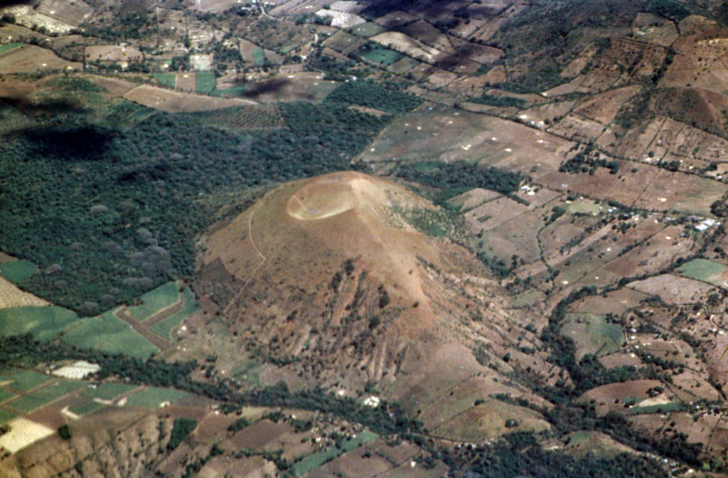
17. Moyuta
Elevation: 1,662 m
Location: Moyuta Volcano is located in the Jutiapa department of southeastern Guatemala, near the town of Moyuta and close to the border with El Salvador.
Duration: 3–4 hours round trip.
Hiking difficulty: easy to moderate.
Unique feature: This volcano is known for its rich agricultural land and diverse ecosystems. It offers scenic views of the surrounding region, the Pacific coastal plain, and the mountains of eastern Guatemala. The volcano has a relatively low elevation compared to other Guatemala volcanoes, making it an easier climb for you while still providing rewarding views.
18. Tecuamburro
Elevation: 1,845 m
Location: Located in the Santa Rosa department of Guatemala, near the town of Chiquimulilla and close to the Pacific coast.
Duration: 3-4 hours round trip.
Hiking difficulty: Easy to moderate.
Unique feature: It is known for its geothermal activity, including hot springs and fumaroles, which provide a unique natural experience. The hike offers you scenic views of the Pacific Ocean and the surrounding lowlands. You will see how the volcanic terrain and lush vegetation add to the beauty of the hike.
19. Volcán Siete Orejas
Elevation: 3,370 m
Location: Located in the Quetzaltenango department of Guatemala, near the city of Quetzaltenango (Xela).
Duration: 6-8 hours round trip.
Hiking difficulty: Moderate to Difficult.
Unique feature: Siete Orejas, meaning “Seven Ears,” is named for its seven distinct peaks. The volcano offers panoramic views of the surrounding highlands, including other volcanoes such as Santa María and Tajumulco.
20. San Salvador Volcano
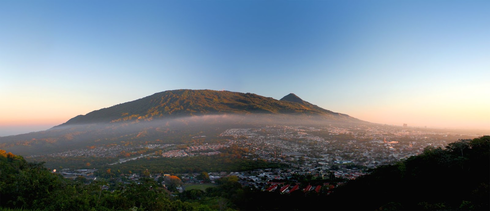
Elevation: 1,893 m
Location: Located near the capital city of El Salvador, San Salvador. It is part of the Boquerón National Park.
Duration: 2–3 hours round trip.
Hiking difficulty: Easy to moderate.
Unique feature: It is a major attraction known as El Boquerón. The crater is approximately 1.5 kilometers wide and 500 meters deep, providing spectacular views. The hike offers you the opportunity to explore the lush vegetation and volcanic features within the national park.
21. Volcán Jumaytepeque
Elevation: 1,815 m
Location: Located in the Santa Rosa department of Guatemala, near the town of Nueva Santa Rosa.
Duration: 3–4 hours round trip.
Hiking difficulty: Easy as compared to other Guatemala volcano hikes.
Unique feature: It is known for its beautiful forested slopes and diverse wildlife. The hike offers scenic views of the surrounding valleys and agricultural fields.
22. Tahual
Elevation: 1,716 m
Location: Located in the Quetzaltenango department of Guatemala, near the town of San Martín Sacatepéquez. It is part of the western highlands of Guatemala.
Duration: 3–4 hours round trip.
Hiking difficulty: Easy
Unique feature: This volcano is known for its beautiful natural scenery, lush forests, and rich biodiversity. You get an opportunity to explore the local culture and traditions of the nearby towns.
23. Santiaguito
Elevation: 2,500 meters
Location: Located on the flank of the Santa María volcano in the Quetzaltenango department of Guatemala. The nearest major city is Quetzaltenango (Xela).
Duration: The hike to the Santiaguito viewpoint typically takes about 4-6 hours round trip. Hiking to the base of Santiaguito is much more challenging and can take a full day or more, often requiring an overnight stay.
Hiking difficulty: The hike to the base of the volcano is strenuous.
Unique feature: One of the most active Guatemala volcanoes that offers a unique opportunity to witness volcanic activity, including frequent ash plumes and lava flows. The area around the dome is hazardous due to regular eruptions and pyroclastic flows, making it unsafe for hiking. Observation points from nearby areas, such as Santa María, are safer alternatives.
Note– 6 to 8 hours of hiking on any volcano does not mean you will have to complete it in a day. Some hikers choose to camp overnight near the summit to enjoy the sunset and sunrise views. Camping allows for a more relaxed pace and the opportunity to fully appreciate the natural beauty.
3 Safety Tips and Best Practices for Hiking Guatemala Volcanoes
1. To enhance your hike, we always recommend you hire a local guide, especially on active volcanoes. They have more knowledge about the volcanoes and can offer valuable advice on safe travel and current circumstances.
2. Always follow and respect the local guidelines and restricted areas. Warnings or advisories given by local authorities, park services, and guide organizations contain current situation reports. They have the most accurate information on the Guatemala volcanoes that can save you from any mishappening, so before heading towards hiking, always check with them for the latest reports of volcanoes and weather conditions.
3. Be Prepared: Ensure you are well-prepared with a down jacket, waterproof jacket and trousers, breathable wicking layers, a fleece jacket, thermals (merino is best), warm hat, buff or neck scarf, sunglasses, sunhat, hiking boots (worn-in), suncream, personal first-aid kit (inc. blister treatment), personal items (biodegradable toiletries, sanitary wear, etc), toilet kit (toilet paper, biodegradable bags to carry out), headtorch, energy bars, snacks, and drinking water. Also, work on your physical strength.
By prioritizing the above-recommended suggestions, you can enjoy your hiking and be able to capture the bright views of Guatemala volcanoes.
The Best Time to Hike Guatemala Volcanoes
It is very important to hike the Guatemala Volcano at the right time. Keeping all the factors in mind, you can have a safe and enjoyable hike.
November to April
1. Stable Weather
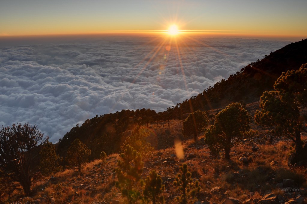
During these months, the weather conditions are stable, with minimal rainfall and clear skies. Minimal rainfall makes the trails less slippery, and clear skies provide breathtaking views from the summit and allow you to fully capture the essence of panoramic landscapes and volcanic features. Stable weather also reduces the risk of landslides and other weather-related hazards, making this the safest time to hike.
2. Popular Events
Semana Santa (Holy Week), occurring in March or April, is a major cultural event that can add a unique experience to your trip, though it may also result in busier trails and accommodations.
Tips: To take advantage of the cooler temperature and clearer skies, begin hikes early in the morning. During the hike don’t forget to keep your body hydrated.
May to October
Challenges
From May to October, it will be challenging for you to hike the Guatemala volcanoes because of increased rainfall and unclear views. An increase in rainfall will cause the trails to be slippery, which will pose a challenge to hike. Rainfall will also cause visibility issues and a higher risk of landslides and flooding on trails, requiring extra caution and preparedness.
Advantages
Rainfall brings lush scenery. Lush greenery and vibrant landscapes will make your hiking memorable. Also, during this season, fewer people prefer to hike, so you will get fewer crowds.
Tips: Don’t forget to keep good waterproof hiking boots, a rain jacket, and a cover for your backpack.
Popular Accommodation Options near Guatemala Volcanoes
In Guatemala, near popular hiking destinations and volcanoes, various accommodation options are available, from luxury to budget-friendly.
Near Quetzaltenango (for Santiaguito, Santa María, and Volcán Siete Orejas)
1. Hotel Casolia
2. Hacienda Grande Hotel
4. Hotel Las Americas
Near Lake Atitlán (for Cerro de Coxóm, Volcán Tolimán, Volcán Atitlán, and Volcán San Pedro)
1. Casa Josefa Hotel
2. Casa González
3. Hosteria del Centro
4. Hotel Tiosh Abaj
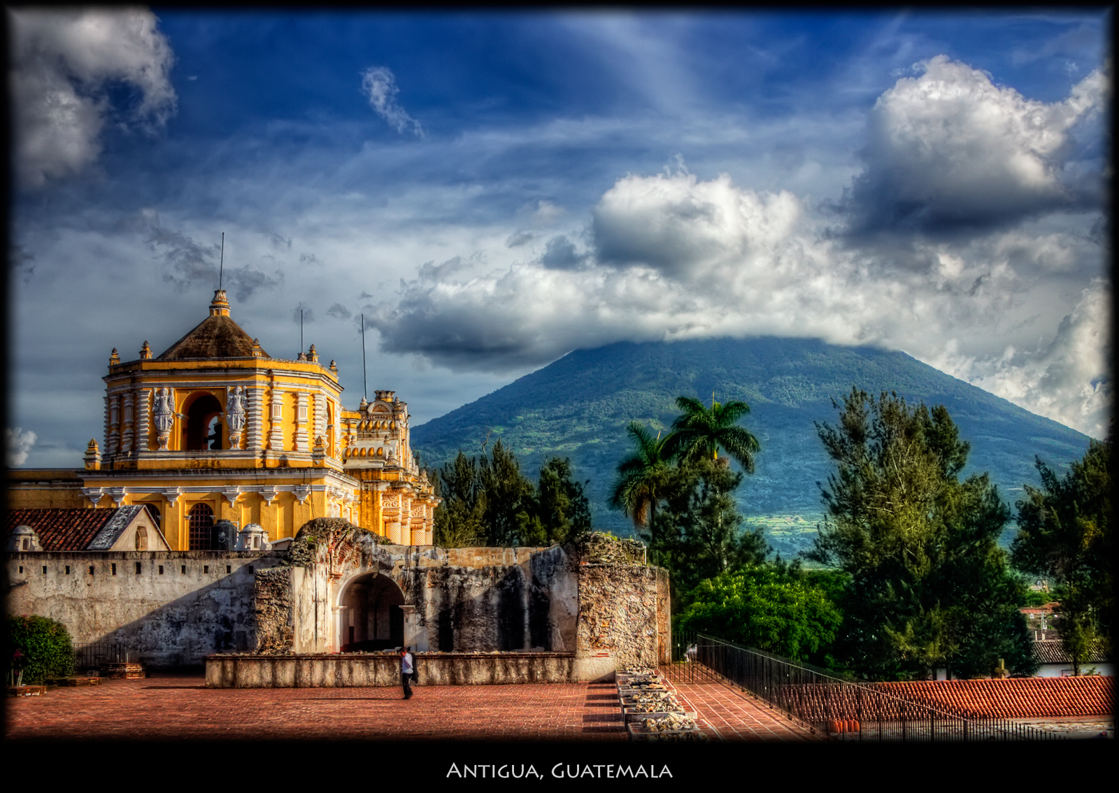
Near Antigua Guatemala (for Acatenango, Volcán de Fuego, Pacaya, and Agua Volcano)
1. Cabaña Cristal
2. Posada del Angel
3. Hotel Casa Santo Domingo
Near San Marcos (for Volcán Tajumulco, and Tacaná)
1. Hotel Berena
2. Del Lago Hotel
3. El Dragon Hotel
4. Hotel Tajumulco
5. Hotel El Viejo
FAQ’s
1. Is Guatemala Volcano still Active?
Yes, Guatemala has several active volcanoes. Volcán de Fuego, Pacaya, and Santiaguito are among the most active, with frequent eruptions and volcanic activity.
2. What Volcano erupts every 15 minutes?
Volcán de Fuego in Guatemala is known for its frequent eruptions, occurring roughly every 15 to 20 minutes. This remarkable activity makes it one of the most active volcanoes in the world.
3. What is the longest erupting Volcano on Earth?
The longest continuously erupting volcano on Earth is Kīlauea in Hawaii. Its Pu‘u‘ō‘ō eruption lasted from January 1983 to April 2018, spanning over 35 years. During this period, it produced significant lava flows, reshaped landscapes, and destroyed numerous structures, making it one of the most prolific and long-lasting eruptions in modern history.